Welcome to the I Can't Sleep podcast,
Where I read random articles from across the web to bore you to sleep with my soothing voice.
I'm your host Benjamin Boster.
Today's episode is from a Wikipedia article titled Mountain.
A mountain is an elevated portion of the earth's crust,
Generally with steep sides that show significant exposed bedrock.
Although definitions vary,
A mountain may differ from a plateau in having a limited summit area,
And is usually higher than a hill,
Typically rising at least 300 meters or 980 feet above the surrounding land.
A few mountains are isolated summits,
But most occur in mountain ranges.
Mountains are formed through tectonic forces,
Erosion,
Or volcanism,
Which act on time scales of up to tens of millions of years.
Once mountain building ceases,
Mountains are slowly leveled through the action of weathering,
Through slumping and other forms of mass wasting,
As well as through erosion by rivers and glaciers.
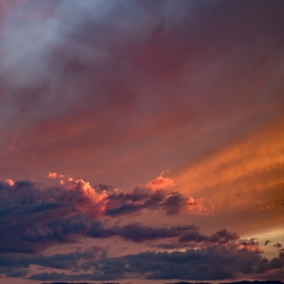
High elevations on mountains produce colder climates than at sea level at similar latitude.
These colder climates strongly affect the ecosystems of mountains.
Different elevations have different plants and animals.
Because of the less hospitable terrain and climate,
Mountains tend to be used less for agriculture and more for resource extraction,
Such as mining and logging,
Along with recreation,
Such as mountain climbing and skiing.
The highest mountain on earth is Mount Everest in the Himalayas of Asia,
Whose summit is 8,
850 meters,
Or 29,
035 feet above mean sea level.
The highest known mountain on any planet in the solar system is Olympus Mons on Mars,
At 21,
171 meters,
Or 69,
459 feet.
There is no universally accepted definition of a mountain.
Elevation,
Volume,
Relief,
Steepness,
Spacing,
And continuity have been used as criteria for defining a mountain.
In the Oxford English Dictionary,
A mountain is defined as a natural elevation of the earth's surface,
Rising more or less abruptly from the surrounding level,
And attaining an altitude which,
Relatively to the adjacent elevation,
Is impressive or notable.
Whether a landform is called a mountain may depend on local usage.
John Widow's Dictionary of Physical Geography states,
Some authorities regard eminences above 600 meters as mountains,
Those below being referred to as hills.
In the United Kingdom and the Republic of Ireland,
A mountain is usually defined as any summit at least 200 feet high,
Which accords with the official UK government's definition that a mountain,
For the purpose of access,
Is a summit of 2,
000 feet or higher.
In addition,
Some definitions also include a topographical prominence requirement,
Such as that the mountain rises 300 meters above the surrounding terrain.
At one time,
The US Board on Geographic Names defined a mountain as being 1,
000 feet or taller,
But has abandoned the definition since the 1970s.
Any similar landform lower than this height was considered a hill.
However,
Today the US Geological Survey concludes that these terms do not have technical definitions in the US.
The UN Environmental Program's definition of mountainous environment includes any of the following.
Class 1,
Elevation greater than 4,
500 meters.
Class 2,
Elevation between 3,
500 meters and 4,
500 meters.
Class 3,
Elevation between 2,
500 meters and 3,
500 meters.
Class 4,
Elevation between 1,
500 meters and 2,
500 meters,
With a slope greater than 2 degrees.
Class 5,
Elevation between 1,
000 meters and 1,
500 meters,
With a slope greater than 5 degrees,
And or 300 meter elevation range within 7 kilometers.
Class 6,
Elevation between 300 meters and 1,
000 meters,
With a 300 meter elevation range within 7 kilometers.
Class 7,
Isolated inner basins and plateaus less than 25 kilometers squared,
An area that are completely surrounded by class 1 to 6 mountains,
But do not themselves meet criteria for class 1 to 6 mountains.
Using these definitions,
Mountains cover 33% of Eurasia,
19% of South America,
24% of North America,
And 14% of Africa.
As a whole,
24% of the Earth's landmass is mountainous.
There are three main types of mountains.
Volcanic,
Fold,
And block.
All three types are formed from plate tectonics,
When portions of the Earth's crust move,
Crumple,
And dive.
Compressional forces,
Isostatic uplift,
And intrusion of igneous matter,
Forces surface rock upward,
Creating a landform higher than the surrounding features.
The height of the feature makes it either a hill,
Or if higher and steeper,
A mountain.
Major mountains tend to occur in long linear arcs,
Indicating tectonic plate boundaries in activity.
Volcanoes are formed when a plate is pushed below another plate,
Or a mid-ocean ridge or hotspot.
At a depth of around 100 kilometers,
Melting occurs in rock above the slab due to the addition of water,
And forms magma that reaches the surface.
When the magma reaches the surface,
It often builds a volcanic mountain,
Such as a shield volcano,
Or a stratovolcano.
Examples of volcano include Mount Fuji in Japan,
And Mount Pinatubo in the Philippines.
The magma does not have to reach the surface in order to create a mountain.
Magma that solidifies below ground can still form dome mountains,
Such as Navajo Mountain in the US.
Fold mountains occur when two plates collide,
Shortening occurs along thrust faults,
And the crust is over-thickened.
Since the less dense continental crust floats on the denser mantle rocks beneath,
The weight of any crustal material forced upward to form hills,
Plateaus,
Or mountains,
Must be balanced by the buoyancy force of a much greater volume force downward into the mantle.
Thus,
The continental crust is normally much thicker under mountains,
Compared to lower-lying areas.
Rock can fold either symmetrically or asymmetrically.
The up-folds are anticlines,
And the down-folds are synclines.
In asymmetric folding,
There may also be recumbent and overturned folds.
The Balkan Mountains and the Jura Mountains are examples of fold mountains.
Block mountains are caused by faults in the crust,
A plane where rocks have moved past each other.
When rocks on one side of a fault rise relative to the other,
It can form a mountain.
The uplifted blocks are block mountains or horsts.
The intervening dropped blocks are termed graben.
These can be small or form extensive rift valley systems.
This form of landscape can be seen in East Africa,
The Vosges and Rhine Valley,
And the Basin and Range Province in western North America.
These areas often occur when the regional stress is extensional and the crust is thinned.
During and following uplift,
Mountains are subjected to the agents of erosion,
Water,
Wind,
Ice,
And gravity,
Which gradually wear the uplifted area down.
Erosion causes the surface of mountains to be younger than the rocks that form the mountains themselves.
Glacial processes produce characteristic landforms,
Such as pyramidal peaks,
Knife-edge aerates,
And bowl-shaped cirques that can contain lakes.
Plateau mountains,
Such as the Catskills,
Are formed from the erosion of an uplifted plateau.
Climate in the mountains becomes colder at high elevations due to an interaction between radiation and convection.
Sunlight in the visible spectrum hits the ground and heats it.
The ground then heats the air at the surface.
If radiation were the only way to transfer heat from the ground to space,
The greenhouse effect of gases in the atmosphere would keep the ground at roughly 333 Kelvin,
And the temperature would decay exponentially with height.
However,
When air is hot,
It tends to expand,
Which lowers its density.
This hot air tends to rise and transfer heat upward.
This is the process of convection.
Convection comes to equilibrium when a parcel of air at a given altitude has the same density as its surroundings.
Air is a poor conductor of heat,
So a parcel of air will rise and fall without exchanging heat.
This is known as an adiabatic process,
Which has a characteristic pressure-temperature dependence.
As the pressure gets lower,
The temperature decreases.
The rate of decrease of temperature with elevation is known as the adiabatic lapse rate,
Which is approximately 9.
8 degrees Celsius per kilometer of altitude.
The presence of water in the atmosphere complicates the process of convection.
Water vapor contains latent heat of vaporization.
As air rises and cools,
It eventually becomes saturated and cannot hold its quantity of water vapor.
The water vapor condenses,
Forming clouds and releases heat,
Which changes the lapse rate from the dry adiabatic lapse rate to the moist adiabatic lapse rate.
The actual lapse rate can vary by altitude and by location.
Therefore,
Moving up 100 meters on a mountain is roughly equivalent to moving 80 kilometers towards the nearest pole.
This relationship is only approximate,
However,
Since local factors such as proximity to oceans can drastically modify the climate.
As the altitude increases,
The main form of precipitation becomes snow and the winds increase.
The effect of the climate on the ecology at an elevation can be largely captured through a combination of amount of precipitation and the biotemperature as described by Leslie Haldridge in 1947.
Biotemperature is the mean temperature.
All temperatures below zero degrees Celsius are considered to be zero degrees Celsius.
When the temperature is below zero degrees Celsius,
Plants are dormant,
So the exact temperature is unimportant.
The peaks of mountains with permanent snow can have a biotemperature below 1.
5 degrees Celsius.
Mountain environments are particularly sensitive to anthropogenic climate change and are currently undergoing alterations unprecedented in last 10,
000 years.
The effect of global warming on mountain regions relative to lowlands is still an active area of study.
Observational studies show that highlands are warming faster than nearby lowlands,
But when compared globally,
The effect disappears.
Precipitation in highland areas is not increasing as quickly as in lowland areas.
Climate simulations give mixed signals about whether a particular island area will have increased or decreased precipitation.
Climate change has started to affect the physical and ecological systems of mountains.
In recent decades,
Mountain ice caps and glaciers have experienced accelerating ice loss.
The melting of the glaciers,
Permafrost,
And snow has caused underlying surfaces to become increasingly unstable.
Landslip hazards have increased in both number and magnitude due to climate change.
Patterns of river discharge will also be significantly affected by climate change,
Which in turn will have significant impacts on communities that rely on water fed from alpine sources.
Nearly half of mountain areas provide essential or supportive water resources for mainly urban populations,
In particular during the dry season and in semi-arid areas such as in Central Asia.
Alpine ecosystems can be particularly climatically sensitive.
Many mid-latitude mountains act as cold climate refugia,
With the ecosystems occupying small environmental niches,
As well as the direct influence that the change in climate can have on an ecosystem.
There's also the indirect one on the soils from changes in stability and soil development.
The colder climate on mountains affects the plants and animals residing on mountains.
A particular set of plants and animals tend to be adapted to a relatively narrow range of climate.
Thus,
Ecosystems tend to lie along elevation bands of roughly constant climate.
This is called altitudinal zonation.
In regions with dry climates,
The tendency of mountains to have higher precipitation as well as lower temperatures also provides for varying conditions,
Which enhances zonation.
Some plants and animals found in altitudinal zones tend to become isolated since the conditions above and below a particular zone will be inhospitable and thus constrain their movements or dispersal.
These isolated ecological systems are known as sky islands.
Altitudinal zones tend to follow a typical pattern.
At the highest elevations,
Trees cannot grow and whatever life may be present will be of the alpine type resembling tundra.
Just below the tree line,
One may find sub alpine forests of needle-leaf trees,
Which can withstand cold,
Dry conditions.
Below that,
Montane forests grow.
In the temperate portions of the earth,
Those forests tend to be needle-leaf trees,
While in the tropics they can be broadleaf trees growing in a rainforest.
The highest known permanently tolerable altitude is at 5,
950 meters.
At very high altitudes,
A decrease in atmospheric pressure means that less oxygen is available for breathing and there is less protection against solar radiation,
UV.
Above 8,
000 meters elevation,
There is not enough oxygen to support human life.
This is sometimes referred to as the death zone.
The summits of Mount Everest and K2 are in the death zone.
Mountains are generally less preferable for human habitation than lowlands because of harsh weather and little level ground suitable for agriculture.
While 7% of the land area of Earth is above 2,
500 meters,
Only 140 million people live above that altitude,
And only 20 to 30 million people above 3,
000 meters elevation.
About half of mountain dwellers live in the Andes,
Central Asia,
And Africa.
With limited access to infrastructure,
Only a handful of human communities exist above 4,
000 meters of elevation.
Many are small and have heavily specialized economies,
Often relying on industries such as agriculture,
Mining,
And tourism.
An example of such a specialized town is La Rinconada,
Peru,
A gold mining town and the highest elevation human habitation at 5,
100 meters.
A counterexample is El Alto,
Bolivia,
At 4,
150 meters,
Which has a highly diverse service and manufacturing economy and a population of nearly 1 million.
Traditional mountain societies rely on agriculture with higher risk of crop failure than at lowered elevations.
Minerals often occur in mountains,
With mining being an important component of the economics of some montane societies.
More recently,
Tourism supports mountain communities with some intensive development around attractions such as national parks or ski resorts.
About 80% of mountain people live below the poverty line.
Most of the world's rivers are fed from mountain sources,
With snow acting as a storage mechanism for downstream users.
More than half of humanity depends on mountains for water.
In geopolitics,
Mountains are often seen as preferable natural boundaries between polities.
Mountain climbing,
Or alpinism,
Is the sport,
Hobby,
Or profession of hiking,
Skiing,
And climbing mountains.
While mountaineering began as attempts to reach the highest point of unclimbed big mountains,
It has branched into specializations that address different aspects of the mountain and consists of three areas,
Rock craft,
Snow craft,
And skiing,
Depending on whether the route chosen is over rock,
Snow,
Or ice.
All require experience,
Athletic ability,
And technical knowledge of the terrain to maintain safety.
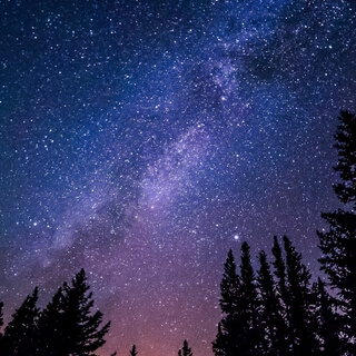
Mountains often play a significant role in religion.
There are,
For example,
A number of sacred mountains within Greece,
Such as Mount Olympus,
Which was held to be the home of the gods.
In Japanese culture,
The 3,
776.
24-meter volcano of Mount Fuji is also held to be sacred,
With tens of thousands of Japanese ascending it each year.
Mount Kailash,
In the Tibet Autonomous Region of China,
Is considered to be sacred in four religions—Hinduism,
Bon,
Buddhism,
And Jainism.
In Ireland,
Pilgrimages are made up the 952-meter Mount Brandon by Irish Catholics.
The Himalayan peak of Nanda Devi is associated with the Hindu goddesses Nanda and Sunanda.
It has been off-limits to climbers since 1983.
Mount Ararat is a sacred mountain,
As it is believed to be the landing place of Noah's Ark.
In Europe,
And especially in the Alps,
Summit crosses are often erected on the tops of prominent mountains.
Heights of mountains are typically measured above sea level.
Using this metric,
Mount Everest is the highest mountain on earth,
At 8,
848 meters.
There are at least 100 mountains with heights of over 7,
200 meters above sea level,
All of which are located in Central and Southern Asia.
The highest mountains above sea level are generally not the highest above the surrounding terrain.
There is no precise definition of surrounding base,
But Denali,
Mount Kilimanjaro,
And Nanga Parbat are possible candidates for the tallest mountain on land by this measure.
The bases of mountain islands are below sea level,
And given this consideration,
Mauna Kea is the world's tallest mountain and volcano,
Rising about 10,
203 meters from the Pacific Ocean floor.
The highest mountains are not generally the most voluminous.
Mauna Loa is the largest mountain on earth in terms of base area and volume.
Mount Kilimanjaro is the largest non-shield volcano in terms of both base area and volume.
Mount Logan is the largest non-volcanic mountain in base area.
The highest mountains above sea level are also not those with peaks farthest from the center of the earth,
Because the figure of the earth is not spherical.
Sea level closer to the equator is several miles farther from the center of the earth.
The summit of Chimborazo,
Ecuador's tallest mountain,
Is usually considered to be the farthest point from the earth's center,
Although the southern summit of Peru's tallest mountain,
Huascaran,
Is another contender.
Both have elevations above sea level more than two kilometers,
Less than that of Everest.
A mountain hut is a building located high in the mountains,
Generally accessible only by foot,
Intended to provide food and shelter to mountaineers,
Climbers,
And hikers.
Mountain huts are usually operated by an alpine club or some organization dedicated to hiking or mountain recreation.
They are known by many names,
Including alpine hut,
Mountain shelter,
Mountain refuge,
Mountain lodge,
And mountain hostel.
It may also be called a refuge hut,
Although these occur in lowland areas too.
Mountain huts can provide a range of services,
Starting with shelter and simple sleeping berths.
Some,
Particularly in remote areas,
Are not staffed,
But others have staff which prepare meals and drinks,
And can provide other services,
Including providing lectures and selling clothing and small items.
Mountain huts usually allow anybody to access their facilities,
Although some require reservations.
While shelters have long existed in mountains,
Modern hut systems date back to the mid-19th century.
The Swiss Alpine Club has built huts since 1863.
In the United States,
The Appalachian Mountain Club built its first hut at Madison Spring in New Hampshire in 1889.
The construction of refugees and shelters in the Alps date back to ancient times,
When Roman roads led across the mountain passes.
In the High Middle Ages,
Hospitales were erected along the trade routes.
Cottages and sheds on the high mountain pastures served for alpine transhumans.
The long history of mountaineering from the 19th century onwards has led to a large number of Alpine Club huts,
As well as private huts,
Along the mountaineering paths.
These huts are categorized according to their location and facilities.
They may have beds or mattresses room for overnight stays.
Just as the Margarita Hut in the Valais Alps is the highest alpine refuge at 4,
554 meters,
The Refugio Mario Premuta in Treste,
Owned by the Italian Alpine Association,
Is the lowest refuge in the Alps at 82 meters.
In the United Kingdom,
The tradition is of unwardened climbing huts providing fairly rudimentary accommodation,
But superior to that of a bothy close to a climbing ground.
The huts are usually conversions,
E.
G.
Of former quarrymen's cottages or of disused mine buildings,
And are not open to passers-by except in emergency.
Many climbing huts in the UK have such huts in Snowdonia or in the Lake District.
A well-known example is the Charles Inglis Clark Memorial Hut,
The CIC Hut,
A purpose-built hut below the northern crags of Ben Nevis in Scotland.
In the past,
Some shelters in Scotland were built in exposed locations at high elevation,
Often as part of military training exercises.
However,
And particularly following the 1971 Cairngorm Plateau disaster,
These were deliberately demolished because they were thought to pose dangers exceeding their benefits.
The Norwegian Trekking Association operates about 460 cabins,
Mostly in the mountains and in forested areas,
Of which about 400 have lodgings.
Many cabins are unstaffed and open all year,
While the staffed cabins often are just open during summer.
In Poland,
Most mountain shelters and huts are run by the Polish Tourist and Sightseeing Society,
With some being privately owned.
In the Polish mountains,
There are about 100 shelters.
Most mountain shelters offer multi-person room and refreshments.
Polish mountain huts are obliged by their own regulations to allow overnight anyone who is not able to find any other place before sunset,
But conditions may be spartan,
E.
G.
A mattress in a hall or warm basement.
In Slovakia,
There is a dense network of mountain huts,
Čata,
In most mountain and forest regions,
Serving a culture of hiking.
In the past,
They were managed by the official tourist union,
But now are mostly in private hands.
Official mountain huts are similar to guest houses and are run by full-time managers.
In winters,
Some refuges are closed.
There are many huts in the United States,
For example in the Rocky Mountains,
The Appalachian Mountains,
And other ranges.
The high huts of the White Mountains in New Hampshire are generally full-service,
Cooks serve food through summer and early fall,
While some are open the rest of the year as half-service huts,
At which hikers bring and prepare their own food.
The Alpine Club of Canada operates what it calls the largest network of backcountry huts in North America.
The New Zealand Department of Conservation manages a network of over 950 huts of all shapes and sizes.
The mountains of Asia do not have a well-developed system of public mountain huts,
Although hiking,
Trekking,
And mountain climbing are common.
In 2015,
A competition was launched to design huts that could be located along trekking trails of Nepal.
Many places in Africa have hiking huts,
But they are usually privately owned and require payment and reservations.
At least one hut is open for public use on Table Mountain in South Africa,
Part of Table Mountain National Park.
The Seven Summits are the highest mountains on each of the seven traditional continents.
Reaching the peak of these summits is considered a significant achievement amongst many mountaineers,
Alongside many other such goals and challenges in the mountaineering community.
On the 30th of April 1985,
Richard Bass became the first climber to reach the summit of all seven.
The Seven Summits consist of the highest mountain peak on each of the continents.
Different lists include slight variations,
But generally the same core is maintained.
The Seven Summits depend on the definition used for a continent,
In particular the location of the border of that continent.
This results in two major points of variation.
The first one is Mont Blanc versus Mount Everest for Europe,
Which depends on whether the crest of the Great Caucasus Mountains is taken to define the Greater Caucasus Watershed,
Which marks the continental boundary between Asia and Europe for the region between the Black and Caspian Seas.
This classification could place Mount Elbrus in Asia instead of Europe.
The second one is Puncak Jaya,
Also known as Khartin's Pyramid,
Versus Mount Cochusco for the continent of Australia,
Which depends on whether one includes the Sahel Shelf or only mainland Australia as the continent.
This also gives rise to another list called the Eight Summits,
Which includes both Puncak Jaya and Mount Cochusco,
Along with the Six Summits on the other continents.
The concept Richard Bass and his climbing partner Frank Wells were pursuing was to be the first to stand atop the highest mountain on each continent.
They pursued this goal as they defined it,
Climbing Aconcagua for South America,
McKinley,
Now Denali,
For North America,
Kilimanjaro for Africa,
Elbrus for Europe,
Vinson for Antarctica,
Cochusco for Australia,
And finally Everest for Asia.
Using the largest tectonic plates,
Asia and Europe could be grouped as Eurasia,
And the very large Pacific Plate would have Mauna Kea as its highest mountain.
Puncak Jaya is actually on the Mayok Plate,
While Mount Wilhelm is on the Woodlark Plate,
Both of which are usually grouped with the larger Australian Plate.
If not,
Then Mount Cochusco would revert to being the highest of that plate.
The highest mountain in mainland Australia is Mount Cochusco,
2,
228 meters above sea level.
However,
The highest mountain in the Australian continent,
Which includes Australia and New Guinea,
Is Puncak Jaya,
4,
884 meters above sea level.
In the Indonesian province of Papua,
And on the island of New Guinea,
Which shares the Sahel continental shelf with Australia.
Mount Cochusco is considerably easier to climb,
Being a four-hour grade 3 return walk from the nearest car park,
While Puncak Jaya is classed as a mountaineering expedition,
With technical climbing,
An approach through dense jungle,
And the need to charter an aircraft.
Some sources claim Mount Wilhelm and Papua New Guinea's Bismarck Range as the highest mountain on the Australian continent,
On account of Indonesia being a part of Asia.
However,
Such a definition is political,
Not geographical.
It would mean that the western part of New Guinea changed continents in 1969.
In terms of Australia as a country,
Mawson Peak is higher than Cochusco.
However,
It is not located in Oceana,
But on Heard Island,
A small offshore island in the southern Indian Ocean.
If excluding the island of New Guinea,
Then Orakei,
Mount Cook,
On the south island of New Zealand,
Is the highest mountain in Australasia,
At 3,
724 meters.
Sources that list Mount Wilhelm as the highest point in Oceana,
Or show boundaries putting Puncak Jaya in Asia,
Include the United Nations,
Seven Continent Summits,
World Atlas,
The CIA World Factbook,
Canada Atlas,
And Papua New Guinea PNG trekking.
The generally accepted highest summit in Europe is Mount Elbrus in the Caucasus,
Appearing on both the Bass and Messner lists.
However,
Because the location of the boundary between Asia and Europe is not universally agreed upon,
Its inclusion in Europe is disputed.
If the Kuma-Manic Depression is used as the geological border between Asia and Europe,
The Caucasus and Elbrus lie wholly in Asia.
If the Greater Caucasus watershed is used instead,
Elbrus' peaks are wholly in Europe,
Albeit close to the border with Asia.
Mont Blanc,
Lying on the border between France and Italy and the Grian Alps,
Is seen by some to be the highest mountain in Europe.
Denali is the highest mountain peak in North America.
The Caribbean Plate and the Panama Plate,
Both of which share geological processes with the North American continent,
Have their own highest mountain peaks.
North America,
Denali,
Caribbean Plate,
Akatanango Volcano,
Panama Plate,
Mount Chiripo.
Aconcagua is the highest mountain peak in South America.
The Altiplano Plate and the North Andes Plate,
Both of which share geological processes with the South American continent,
Have their own highest mountain peaks.
South America,
Aconcagua,
Altiplano Plate,
Probably Nevado-Sajama,
North Andes Plate,
Chimborazo.
The first seven summits list as postulated by Bass,
Chose the highest mountain of mainland Australia,
Mount Cochusco,
To represent the Australian continent's highest summit.
Reinhold Messner postulated another list,
Replacing Mount Cochusco with Indonesia's Punggok Jaya.
Neither the Bass nor the Messner list includes Mont Blanc.
From a mountaineering point of view,
The Messner list is the more challenging one.
Climbing Karsten's Pyramid has the character of an expedition,
Whereas the ascent of Cochusco is an easy hike.
Indeed,
Patrick Morrow used this argument to defend his choice to adhere to the Messner list.
Being a climber first and a collector second,
I felt strongly that Karsten's Pyramid,
The highest mountain in Australasia,
Was a true mountaineer's objective.
In 1956,
William D.
Hackett,
An American mountaineer,
Reached the top of five continents.
He climbed Denali,
Then known as Mount McKinley,
Aconcagua,
Kilimanjaro,
Cochusco,
And Mont Blanc.
At that time,
Mont Blanc was considered to be the highest mountain of the European continent.
Hackett made an attempt to climb Mount Vinson and obtained a permit to Mount Everest in 1960.
But due to several circumstances—frostbite,
Lack of funds,
Etc.
—he never made it to more than five summits.
In 1970,
The Japanese mountaineer and adventurer Naomi Uemura was the first person to reach five of the seven summits,
Including Mount Everest.
He climbed Mount Blanc,
Kilimanjaro,
Aconcagua,
Mount Everest,
And Denali.
After the first solo trip to the North Pole,
He planned to go on his own to Antarctica to climb Mount Vinson.
In preparation for the Antarctica expedition,
He did a solo winter ascent of Denali.
On the descent,
He disappeared in a winter storm.
In 1978,
The Italian mountaineer Reinhold Messner was the first person to reach six of the seven summits.
For Messner,
Kerstin's pyramid was the highest peak in Australia.
But in 1983,
He climbed Mount Cochusco to also satisfy the other geographic definition of Australia.
In the same year,
Messner climbed Mount Elbrus and declared that it was the true highest peak in Europe.
This definition was quickly accepted by others in the mountaineering community.
Finally,
In 1986,
He climbed Mount Vinson.
At that time,
He was only the fifth person to reach the seven summits.
In 1985,
Richard Bass,
A businessman and amateur mountaineer,
Was the first man to climb all seven summits.
In only one year,
1983,
He climbed six peaks.
Acconcagua,
Denali,
Kilimanjaro,
Mount Elbrus,
Mount Vinson,
And Mount Cochusco.
All of these climbs he did together with his companion Frank Wells and different mountain guides.
Beginning in 1983,
Bass and Wells made various guided attempts to climb Mount Everest,
The highest and most difficult peak in the list.
On the 30th of April 1985,
Bass reached the summit of Mount Everest in a party without Wells,
Guided by the American professional mountaineer David Brearshears.
He then co-authored the book Seven Summits,
Which covered the undertaking.
Later in 1985,
American mountaineer Jerry Roach became the second person to climb the Seven Summits.
In 1986,
The Canadian mountaineer Patrick Morrow became the first man to climb the Seven Summits in the Karstens version.
He climbed Denali,
Acconcagua,
Mount Everest,
Kilimanjaro,
Mount Cochusco,
Mount Vinson,
Mount Elbrus,
And finally the Puncak Chaya,
Karstens Pyramid,
On May 7th,
1986.
Morrow was also the first to complete both lists,
Bass and Messner.
In 1990,
Rob Hall and Gary Ball became the first to complete the Seven Summits in seven months.
Using the Bass list,
They started with Everest on the 10th of May 1990 and finished with Vinson on the 12th of December 1990,
Hours before the seven-month deadline.
In 1902,
Junko Tabe became the first woman to complete the Seven Summits.
Mary Dolly Lefevre became the first American woman to climb the Seven Summits on March 11th,
1993,
When she climbed Australia's Mount Cochusco.
Earlier in 1993,
She had become the oldest surviving woman to have reached the summit of Mount Everest.
She was 47 years old.
In January 1986,
Chris Haver became the first American to climb and ski all Seven Summits.
Yasuko Namba was famous in her native Japan for becoming the second Japanese woman to reach all of the Seven Summits,
Including Everest,
Where she died during the storm of May 1996 during her descent.