Welcome to the I Can't Sleep Podcast,
Where I help you learn some interesting facts about the world around us,
Until you drift off to sleep.
I'm your host,
Benjamin Boster,
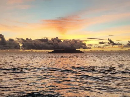
And tonight let's learn about the Mariana Trench.
The Mariana Trench is an oceanic trench located in the western Pacific Ocean,
About 200 kilometers east of the Mariana Islands.
It is the deepest oceanic trench on Earth.
It is crescent-shaped and measures about 2,
550 kilometers in length and 69 kilometers in width.
The maximum known depth is 10,
984 plus or minus 25 meters at the southern end of a small slot-shaped valley in its floor,
Known as the Challenger Deep.
The deepest point of the trench is more than 2 kilometers farther from sea level than the peak of Mount Everest.
At the bottom of the trench,
The water column above exerts a pressure of 1,
086 bar.
And if you don't know what a bar is,
Then that's about 15,
750 psi,
More than 1,
071 times the standard atmospheric pressure at sea level.
At this pressure,
The density of water is increased by 4.
96 percent.
The temperature at the bottom is 1 to 4 degrees Celsius.
In 2009,
The Mariana Trench was established as a U.
S.
National Monument,
Mariana Trench Marine National Monument.
One-celled organisms,
Called monothelenia,
Have been found in the trench at a record depth of 10.
6 kilometers below the sea surface by researchers from the Scripps Institution of Oceanography.
Data has also suggested that microbial lifeforms thrive within the trench.
The Mariana Trench is named after the nearby Mariana Islands,
Which are named Las Marianas in honor of Spanish Queen Mariana of Austria.
The islands are part of the island arc that is formed on an overriding plate,
Called the Mariana Plate,
Also named for the islands,
On the western side of the trench.
The Mariana Trench is part of the Izu-Bonin-Mariana subduction system that forms the boundary between two tectonic plates.
In the system,
The western edge of one plate,
The Pacific Plate,
Is subducted,
I.
E.
Thrust,
Beneath the smaller Mariana Plate that lies to the west.
Crustal material at the western edge of the Pacific Plate is some of the oldest oceanic crust on Earth,
Up to 170 million years old,
And is,
Therefore,
Cooler and denser,
Hence its great height difference relative to the higher-riding and younger Mariana Plate.
The deepest area at the plate boundary is the Mariana Trench proper.
The movement of the Pacific and Mariana Plates is also indirectly responsible for the formation of the Mariana Islands.
These volcanic islands are caused by flux melting of the upper mantle,
Due to the release of water that is trapped in minerals of the subduction portion of the Pacific Plate.
The trench was first sounded during the Challenger expedition in 1875,
Using a weighted rope which recorded a depth of 4,
475 fathoms.
And if you don't go by fathoms,
Then that's about 26,
850 feet.
In 1877,
A map was published called Tiefenkarte des Großen Ozeans,
Depth Maps of the Great Ocean,
By Petterman,
Which showed a Challenger Tief,
Or Challenger Deep,
At the location of that sounding.
In 1899,
USS Nero,
A converted collier,
Recorded a depth of 5,
269 fathoms,
Or 31,
614 feet.
In 1951,
Under Chief Scientist Thomas Gaskell,
Challenger 2 surveyed the trench using echo sounding,
A much more precise and vastly easier way to measure depth than the sounding equipment and drag lines used in the original expedition.
During this survey,
The deepest part of the trench was recorded,
When the Challenger 2 measured a depth of 5,
960 fathoms,
Or 35,
760 feet,
At 11 degrees,
19 minutes north,
142 degrees,
15 minutes east,
Known as the Challenger Deep.
In 1957,
The Soviet vessel Vityaz reported a depth of 11,
034 meters,
At a location dubbed the Mariana Hollow.
In 1962,
The surface ship MV Spencer F.
Baird recorded a maximum depth of 10,
915 meters,
Using precision depth gauges.
In 1984,
The Japanese survey vessel Takuyo collected data from the Mariana Trench using a Nero multi-beam echo sounder.
It reported a maximum depth of 10,
924 meters,
Also reported as 10,
920 plus or minus 10 meters.
Remotely operated vehicle Kaiko reached the deepest area of the Mariana Trench and made the deepest diving record of 10,
911 meters on the 24th of March,
1995.
During surveys carried out between 1997 and 2001,
A spot was found along the Mariana Trench that had a depth similar to the Challenger Deep,
Possibly even deeper.
It was discovered while scientists from the Hawaii Institute of Geophysics and Planetology were completing a survey around Guam.
They used a sonar mapping system towed behind the research ship to conduct the survey.
This new spot was named the HMRG,
Hawaii Mapping Research Group Deep,
After the group of scientists who discovered it.
On June 1st,
2009,
Mapping aboard the RV Kilo Moana,
Mothership of the Nereus vehicle,
Indicated a spot with a depth of 10,
971 meters.
The sonar mapping of the Challenger Deep was possible by its Simrad EM120 sonar multi-beam basymetry system for deep water.
The sonar system uses phase and amplitude bottom detection,
With an accuracy of better than 0.
2% of water depth across the entire swath,
Implying that the depth figure is accurate to plus or minus 22 meters.
In 2011,
It was announced at the American Geophysical Union fall meeting that a U.
S.
Navy hydrographic ship equipped with a multi-beam echosounder conducted a survey which mapped the entire trench to 100-meter resolution.
The mapping revealed the existence of four rocky outcrops,
Thought to be from the seamounts.
The Mariana Trench was a site chosen by researchers at Washington University in St.
Louis and the Woods Hole Oceanographic Institute in 2012 for a seismic survey to investigate the subsurface water cycle.
Using both ocean-bottom seismometers and hydrophones,
The scientists were able to map structures as deep as 97 kilometers beneath the surface.
As of 2022,
22 crude descents and seven uncrewed descents have been achieved.
The first was the crude descent by Swiss-designed,
Italian-built,
United States Navy-owned Bathyscaf Trista,
Which reached the bottom at 1.
06 p.
M.
On the 23rd of January 1960 with Don Walsh and Jacques Piccard on board.
Iron shot was used for ballast,
With gasoline for buoyancy.
The on-board systems indicated a depth of 30,
800 feet,
But this was later revised to 35,
814 feet.
The depth was estimated from a conversion of pressure measured and calculations based on the water density from sea surface to seabed.
This was followed by the uncrewed ROVs Keiko in 1996 and Nereus in 2009.
The first three expeditions directly measured very similar depths of 10,
902 to 10,
916 meters.
The fourth was made by Canadian film director James Cameron on the 26th of March 2012.
He reached the bottom of the Mariana Trench in the submersible vessel Deep Sea Challenger,
Diving to a depth of 10,
908 meters.
In July 2015,
Members of the National Oceanic and Atmospheric Administration,
Oregon State University,
And the Coast Guard submerged a hydrophone into the deepest part of the Mariana Trench,
The Challenger Deep,
Never having previously deployed one past a mile.
The titanium-shelled hydrophone was designed to withstand the immense pressures seven miles under.
Although researchers were unable to retrieve the hydrophone until November,
The data capacity was full within the first 23 days.
After months of analyzing the sounds,
The experts were surprised to pick up natural sounds like earthquakes,
Typhoons,
Bailing whales,
And machine-made sounds such as boats.
Due to the mission's success,
The researchers announced plans to deploy a second hydrophone in 2017 for an extended period of time.
Victor Vescovo achieved a new record descent to 10,
928 meters on the 28th of April 2019 using the DSV Limiting Factor,
A Triton 36002 model manufactured by Florida-based Triton Submarines.
He dived four times between the 28th of April and the 5th of May 2019,
Becoming the first person to dive into Challenger Deep more than once.
On the 8th of May 2020,
A joint project between the Russian shipbuilders,
Scientific teams of the Russian Academy of Sciences,
With the support of the Russian Foundation for Advanced Research Projects,
And the Pacific Fleet submerged the autonomous underwater vehicle VTX-D to the bottom of the Mariana Trench at a depth of 10,
028 meters.
VTX-D is the first underwater vehicle to operate autonomously at the extreme depths of the Mariana Trench.
The duration of the mission,
Excluding diving and surfacing,
Was more than three hours.
On the 10th of November 2020,
The Chinese submersible Fendozhe reached the bottom of the Mariana Trench at a depth of 10,
909 meters.
The expedition,
Conducted in 1960,
Claimed to have observed,
With great surprise because of the high pressure,
Large creatures living at the bottom,
Such as flatfish about 30 centimeters long and shrimp.
According to Picard,
The bottom appeared light and clear,
A waste of firm diatomaceous ooze.
Many marine biologists are now skeptical of the supposed sighting of the flatfish,
And it is suggested that the creature may instead have been a sea cucumber.
During the second expedition,
The uncrewed vehicle Kaiko collected mud samples from the seabed.
Tiny organisms were found to be living in those samples.
In July 2011,
A research expedition deployed untethered landers,
Called drop cams,
Equipped with digital video cameras and lights to explore the deep-sea region.
Among many other living organisms,
Some gigantic single-celled foraminiferans with a size of more than 10 centimeters,
Belonging to the class Monothalami,
Were observed.
Monothalami are noteworthy for their size,
Their extreme abundance on the seafloor,
And their role as hosts for a variety of organisms.
In December 2014,
A new species of snailfish was discovered at a depth of 8,
145 meters,
Breaking the previous record for the deepest living fish seen on video.
During the 2014 expedition,
Several new species were filmed,
Including huge amphipods,
Known as supergiants.
Deep-sea gigantism is a process where species grow larger than their shallow water relatives.
In May 2017,
An unidentified type of snailfish was filmed at a depth of 8,
178 meters.
Oceanic trenches are prominent long,
Narrow topographic depressions of the ocean floor.
They are typically 50 to 100 kilometers wide,
And 3 to 4 kilometers below the level of the surrounding oceanic floor,
But can be thousands of kilometers in length.
There are about 50,
000 kilometers of oceanic trenches worldwide,
Mostly around the Pacific Ocean,
But also in the eastern Indian Ocean and a few other locations.
The greatest ocean depth measured is in the Challenger Deep of the Mariana Trench,
At a depth of 10,
994 meters below sea level.
Oceanic trenches are a feature of the Earth's distinctive plate tectonics.
They mark the locations of convergent plate boundaries,
Along with lithospheric plates move towards each other at rates that vary from a few millimeters to over 10 centimeters per year.
Oceanic lithosphere moves into trenches at a global rate of about 3 square kilometers per year.
A trench marks the position at which the flexed subducting slab begins to descend beneath another lithospheric slab.
Trenches are generally parallel to and about 200 kilometers from a volcanic arc.
Much of the fluid trapped in sediments of the subducting slab returns to the surface at the oceanic trench,
Producing mud,
Volcanoes,
And cold seeps.
These support unique biomes based on chemotrophic microorganisms.
There are approximately 50,
000 kilometers of convergent plate margins worldwide.
These are mostly located around the Pacific Ocean,
But are also found in the eastern Indian Ocean,
With a few shorter convergent margin segments in other parts of the Indian Ocean,
In the Atlantic Ocean,
And in the Mediterranean.
They are found on the oceanward side of island arcs and Andean-type origins.
Globally,
There are over 50 major ocean trenches,
Covering an area of 1.
9 million square kilometers,
Or about a half a percent of the oceans.
Trenches are geomorphologically distinct from troughs.
Troughs are elongated depressions of the seafloor,
With steep sides and flat bottoms,
While trenches are characterized by a V-shaped profile.
Trenches that are partially infilled are sometimes described as troughs,
For example the Makran Trough.
Some trenches are completely buried,
And lack bathymetric expression,
As in the Cascadia subduction zone,
Which is completely filled with sediments.
Despite their appearance,
In these instances,
The fundamental plate tectonic structure is still an oceanic trench.
Some troughs look similar to oceanic trenches,
But possess other tectonic structures.
One example is the Lesser Antilles Trough,
Which is the four-arc basin of the Lesser Antilles subduction zone.
Also not a trench is the New Caledonia Trough,
Which is an extensional sedimentary basin related to the Tonga Kermatic subduction zone.
Additionally,
The Cayman Trough,
Which is a pull-apart basin within a transformed fault zone,
Is not an oceanic trench.
Trenches,
Along with volcanic arcs and Wadadi-Beniyav zones,
Zones of earthquakes under a volcanic arc,
Are diagnostic of convergent plate boundaries and their deeper manifestations,
Subduction zones.
Here,
Two tectonic plates are drifting into each other at a rate of a few millimeters to over 10 centimeters per year.
At least one of the plates is oceanic lithosphere,
Which plunges under the other plate to be recycled in the Earth's mantle.
Trenches are related to,
But distinct from,
Continental collision zones,
Such as the Himalayas.
Unlike in trenches,
In continental collision zones,
Continental crust enters a subduction zone.
When buoyant continental crust enters a trench,
Subduction comes to a halt and the area becomes a zone of friction.
Trenches are also a type of continental collision.
Features analogous to trenches are associated with collision zones.
One such feature is the peripheral foreland basin,
A sediment-filled foredeep.
Examples of peripheral foreland basins include the floodplains of the Ganges River and the Tigris-Euphrates River system.
These are not clearly defined until the late 1940s and 1950s.
The bathymetry of the ocean was poorly known prior to the Challenger expedition of 1872 to 1876,
Which took 492 soundings of the deep ocean.
At station number 225,
The expedition discovered Challenger Deep,
Now known to be the southern end of the Mariana Trench.
The laying of transatlantic telegraph cables on the seafloor between the continents during the late 19th and early 20th centuries provided further motivation for improved bathymetry.
The term trench,
In its modern sense of a prominent elongated depression of the sea bottom,
Was first used by John Stone in his 1923 textbook,
An Introduction to Oceanography.
During the 1920s and 1930s,
Felix Andres Venning Minas measured gravity over trenches using a newly developed gravimeter that could measure gravity from aboard a submarine.
He proposed the tectogene hypothesis to explain the belts of negative gravity anomalies that were found near island arcs.
According to this hypothesis,
The belts were zones of downwelling of light crustal rock arising from sub-crustal convection currents.
The tectogene hypothesis was further developed by Griggs in 1939,
Using an analog model based on a pair of rotating drums.
Harry Hammond Hess substantially revised the theory based on his geological analysis.
World War II in the Pacific led to great improvements of bathymetry particularly in the western Pacific.
In light of these new measurements,
The linear nature of the deeps became clear.
There was a rapid growth of deep sea research efforts,
Especially the widespread use of echo sounders in the 1950s and 1960s.
These efforts confirmed the morphological utility of the term trench.
Important trenches were identified,
Sampled,
And mapped via sonar.
The early phase of trench exploration reached its peak with the 1960 descent of the Bathyscoph Trista to the bottom of the Challenger Deep.
Following Robert S.
Dietz and Harry Hess's promulgation of the seafloor spreading hypothesis in the early 1960s and the plate tectonic revolution in the late 1960s,
The oceanic trench became an important concept in plate tectonic theory.
Oceanic trenches are 50 to 100 kilometers wide and have an asymmetric v-shape with a steeper slope 8 to 20 degrees on the inner overriding side of the trench and the gentler slope around 5 degrees on the outer subducting side of the trench.
The bottom of the trench marks the boundary between the subducting and overriding plates known as the basal plate boundary shear or the subduction décollement.
The depths of the trench depends on the starting depths of the oceanic lithosphere as it begins its plunge into the trench,
The angle at which the slab plunges,
And the amount of sedimentation in the trench.
Both starting depths and subduction angle are greater for older oceanic lithosphere,
Which is reflected in the deep trenches of the western Pacific.
Here the bottoms of the Marianas and the Tonga chromatic trenches are up to 10 to 11 kilometers below sea level.
In the eastern Pacific,
Where the subducting oceanic lithosphere is much younger,
The depth of the Peru-Chile trench is around 7 to 8 kilometers.
Though narrow,
Oceanic trenches are remarkably long and continuous,
Forming the largest linear depressions on earth.
An individual trench can be thousands of kilometers long.
Most trenches are convex towards the subducting slab,
Which is attributed to the spherical geometry of the earth.
The trench asymmetry reflects the different physical mechanisms that determine the inner and outer slope angle.
The outer slope angle of a trench is determined by the bending radius of the subducting slab,
As determined by its elastic thickness.
Since oceanic lithosphere thickens with age,
The outer slope angle is ultimately determined by the age of the subducting slab.
The inner slope angle is determined by the angle of repose of the overriding plate edge.
This reflects frequent earthquakes along the trench that prevent over-steepening of the inner slope.
As the subducting plate approaches the trench,
It bends slightly upwards before beginning its plunge into the depth.
As a result,
The outer trench slope is bounded by an outer trench high.
This is subtle,
Often only tens of meters high,
And is typically located a few tens of kilometers from the trench axis.
On the outer slope itself,
Where the plate begins to bend downwards into the trench,
The upper part of the subducting slab is broken by bending faults that give the outer trench slope a horsed and graben topography.
The formation of these bending faults is suppressed,
Where oceanic ridges or large seamounts are subducting into the trench.
But the bending faults cut right across smaller seamounts.
Where the subducting slab is only thinly veneered with sediments,
The outer slope will often show seafloor spreading ridges,
Oblique to the horsed and graben ridges.